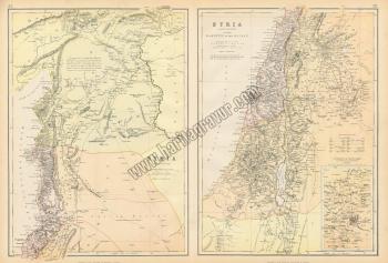
Syria map (with Lebanon, Palestine, Israel, part of Turkey), 1882, (Suriye Haritası)

"Syria", published in Blackie's The Comprehensive Atlas & Geography of the World, 1882. Includes Lebanon, Palestine, Israel and part of Turkey, split over two maps on one sheet. Colour lithographic map, cent Refold as published, good condition.
Ressam
Blackie's The Comprehensive Atlas & Geography of the World
Yayınlayan
Blackie's The Comprehensive Atlas & Geography of the World
Renk
Siyah / Beyaz
Kağıt
1. hamur, 200 gram
Dış Ebat
21,00x28,00 cm.
Basım Yeri
London
Basım Tarihi
1882
Baskı Türü
Steel engraving (Çelik baskı)
Kondisyon
Orijinal, İyi durumda
Stok Kodu
312585
Yorumlar
Yorum yaz
Bu ürün için henüz kimse yorum yazmamış.
%20 İNDİRİMLİ GRAVÜRLER

