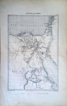
Egypte et Syrie

Atlas of the campaigns of the French Revolution, by Adolphe Thiers, with 32 black and white double page maps and plans. Drawn by Duvontenay and engraved by Dyonnet. Published by Furne, Jouvet publishers, in Paris, without date. Maps are uncolored, showing countries, cities, towns, villages, roads, rivers, forests and mountains. Atlas bound in half red leather red covers with "A Thie. Histoi de la revolu. Francai Atlas" (Histoire de la Revolution française atlas) embossed on the spine in gilt.
Ressam
Duvontenay
Hattat / Hakkak / Oyma Sanatçısı
Ch. Dyonnet
Yayınlayan
Jouvet et Cie Furne
Renk
Siyah / Beyaz
Kağıt
1. hamur
Dış Ebat
27,50x42,50 cm.
Basım Yeri
Paris
Basım Tarihi
1846
Baskı Türü
Steel engraving (Çelik baskı)
Kondisyon
Orijinal, Çok iyi durumda
Stok Kodu
401429
Yorumlar
Yorum yaz
Bu ürün için henüz kimse yorum yazmamış.
%20 İNDİRİMLİ GRAVÜRLER

